
Mining and Aggregate

Mining and Aggregate

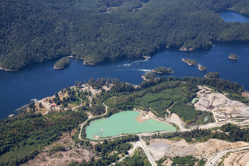
ON-DEMAND AERIAL SURVEYS
ODAS®
Mining and Aggregate
ON-DEMAND AERIAL MAPPING
Elevate your Business to New Heights
ARA Robotics has developed a solution that's a game-changer for the Mining and Aggregates Industries; ODAS® — the On-Demand Aerial Survey technology. With this cutting-edge solution, you can collect field data faster than ever and access comprehensive reports just hours after the scans, enabling substantial cost reductions. Take your business to the next level and redefine your operational efficiency with ODAS®.

40
min*
Flight time
-40 to +50
°C
Operating temperature
45
km/h
Maximum wind resistance
160
-
ha (at 1.9 cm/px)**
Maximum coverage per flight

HIGH PRECISION AERIAL DATA
Revolutionizing Mining Management
Our aerial survey technology delivers a comprehensive, real-time view of your operations, with rapid data processing and high-resolution 2D & 3D models that transform how you manage and optimize mining activities. We start with a detailed site assessment to define your project’s specific requirements and establish a tailored drone infrastructure. Operated remotely by our expert team in Montréal—on a scheduled or on-demand basis—our drones ensure that every dataset meets the highest standards of accuracy and quality.


THE ODAS® ADVANTAGE
Remote Monitoring, Real Results
ODAS® keeps your mining operations continuously monitored from our Command and Control Center (CCC), giving you the insights needed to make informed decisions without being on-site. With no internal drone program required, you avoid complex management responsibilities as our certified pilots in Montréal handle both scheduled flights and on-demand missions. Your team only performs simple pre-flight checks, while we take care of the rest, ensuring a seamless and reliable solution that prioritizes ease of use and operational efficiency.

SCHEDULED OR ON-DEMAND DRONE SURVEY
NO PILOT ON-SITE
WE OPERATE IT REMOTELY
3H FROM FLIGHT TO REPORT FOR QUICK INVENTORIES
NO INTERNAL DRONE PROGRAM REQUIRED

Traditional solution vs ODAS®
SMART OPERATIONS
Maximize Savings, Minimize Costs
Watch your bottom line soar as ODAS® helps decrease operational downtime, which yields improved operational costs. Precision insights mean resource allocation is smarter, and your budget works more efficiently for you.
CUSTOM-FIT INNOVATION
NO INTERNAL DRONE PROGRAM REQUIRED
Tailored Solutions for Your Mine
No two mines are the same, and neither are their challenges. ODAS® is customizable to fit the unique demands of your mining operation. From open-pit to underground, our technology seamlessly integrates into your workflow, ensuring maximum impact.
CUSTOM-FIT INNOVATION
Tailored Solutions for Your Mine
No two mines are the same, and neither are their challenges. ODAS® is customizable to fit the unique demands of your mining operation. From open-pit to underground, our technology seamlessly integrates into your workflow, ensuring maximum impact.
NO INTERNAL DRONE PROGRAM REQUIRED

ENVIRONMENT RISK MANAGEMENT
NO INTERNAL DRONE PROGRAM REQUIRED
Better Decision-Making and Site Monitoring
Adopt ODAS® to better monitor your site’s critical data; our solution provides you with real time ore, tailings, water and sterile inventory, helping you and your team better coordinate with crucial site management decisions. Frequent digitalization of your mine becomes effortless with our drones, greatly simplifying the process of monitoring changes on your site.
Current Services & Applications
Supported by ODAS®
Ore Inventory Precision
Efficiently manage ore and stockpile volumes with precise volumetric analysis, ensuring accurate inventory assessments and operational planning.
Tailings Storage Safety
Ensure the safety and stability of tailings storage with continuous topographic monitoring and change detection, mitigating environmental risks.
Wildlife Conservation Support
Protect and monitor wildlife using automated, scheduled aerial routes, minimizing human impact while maximizing observational efficiency.
Advanced Water Management
We use advanced topographic and bathymetric techniques to obtain accurate water volume calculations, thereby improving the sustainable management of your water resources.
Robust Infrastructure Integrity
Maintain and assess the integrity of critical infrastructure through comprehensive scans, safeguarding against potential failures.
Tributary Health Surveillance
Oversee and inspect tributary discharges through aerial monitoring, ensuring environmental compliance and water quality management.
Optimized Building Energy Use
Analyze building energy efficiency through detailed thermographic inspections, helping to reduce energy consumption and enhance sustainability.
Efficient Construction Oversight
Streamline construction projects with detailed elevation models, orthophotos, and point clouds for better planning, monitoring, and archival processes.
*The ARA405 has a maximum tested flight duration of 40 minutes with a Sony Alpha 7R V payload. However, the actual flight time of a drone can vary widely due to numerous influencing factors and should not be expected to be consistent.
**Environmental conditions and flight parameters, such as temperature, altitude above sea level and wind speed can influence drone behavior and flight duration, leading to variable outcomes.